Törbel
Törbel
| |
|---|---|
| Comuna da Suíça | |
| |
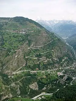
| Törbel vista de Grächen. | |
| Administração | |
| Cantão | Valais |
| Distrito | Visp |
| Comunas limítrofes |
Bürchen, Embd, Grächen, Stalden, Unterbäch, Zeneggen |
| Código postal | 3923 |
| Prefixo telefónico | 027 |
| Língua oficial | alemão |
| Demografia | |
| População | 522 hab. |
| Densidade | 30 hab./km² |
| Geografia | |
| Coordenadas | 46° 14' N 7° 50' E |
| Altitude | 1.497 m |
| Área | 17,31 km² |
| Website oficial | www.toerbel.ch |
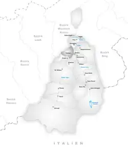
| Localização | |
| |
| ver | |
Törbel é uma comuna da Suíça, no Cantão Valais. Estende-se por uma área de 17,31 km², de densidade populacional de 30 hab/km². Faz fronteiras com as seguintes comunas: Bürchen, Embd, Grächen, Stalden, Unterbäch, Zeneggen.
A língua oficial nesta comuna é o Alemão.[1]
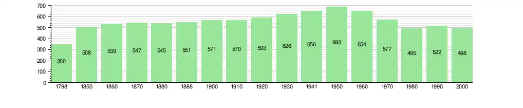
A evolução histórica da população de Törbel é:[2][3]
Referências
- ↑ STAT-TAB Datenwürfel für Thema 40.3 – 2000 Arquivado em 9 agosto 2013 no Wayback Machine (em alemão). Retrieved 2 February 2011
- ↑ «Historical Dictionary of Switzerland». Wikipedia (em inglês). 5 de outubro de 2025. Consultado em 6 de outubro de 2025
- ↑ Swiss Federal Statistical Office STAT-TAB Bevölkerungsentwicklung nach Region, 1850-2000 Arquivado em 30 setembro 2014 no Wayback Machine (em alemão). Retrieved 29 January 2011