Caméria
Caméria
Çamëria Τσαμουριά Chameria, Chaméria | |
|---|---|
| Localização | |
![Contorno geográfico aproximado de Caméria, segundo diversas perspectivas. Em vermelho, o caza otomano de Çamlık. Em preto, a extensão máxima da língua albanesa. Em verde, a versão mais abrangente da definição da região por R. Elsie.[1]](./_assets_/0c70a452f799bfe840676ee341124611/Tsamouria.Chameria.png) |
A Caméria[nota 1] (em albanês: Çamëria; em grego: Τσαμουριά, Tsamouriá) [2] é uma região histórica ao longo da costa do Mar Jônico no sudoeste da Albânia e noroeste da Grécia, tradicionalmente associada ao subgrupo étnico albanês dos Chams.[1][3] Por um breve período (1909–1912), três cazas (Filat, Aydonat e Margiliç) foram combinadas pelos otomanos em um distrito administrativo chamado Sanjaco de Çamlik.[4] Durante o período entreguerras, o topônimo era de uso comum[5] e o nome oficial da área acima do rio Aqueronte em todos os documentos do estado grego.[6] O termo é usado hoje principalmente por albaneses[7] e está obsoleto em grego,[8] sobrevivendo em algumas canções folclóricas antigas. A maior parte do que é chamado de Chameria é dividida entre partes das unidades regionais gregas de Thesprotia, Preveza e Ioannina (algumas aldeias no lado ocidental); e o município de Konispol, no extremo sul da Albânia. Além dos usos geográficos e etnográficos, na Albânia contemporânea, o topônimo também adquiriu conotações irredentistas.[7]
Nome e definição
Nome
Na Idade Média, esta área era conhecida como Vagenécia.
Chameria era usado principalmente como um termo para a região da moderna Tesprácia, durante o domínio otomano.[9][10] Sua etimologia é incerta. Possivelmente deriva do antigo nome grego do rio Tiâmis, chamado Cham (Çam) em albanês, seja através do eslavo não atestado *čamь ou *čama, traduzindo o antigo eslavo *tjama, ou uma continuação direta dele.[11]
Nos relatos de viagens europeus, o termo aparece pela primeira vez no início do século XIX.[12] O termo não foi usado na administração territorial otomana antes do século XX.[12]
Geografia e limites

Nos tempos modernos, a região de Chameria foi reduzida ao território dialetológico dos Chams, estendendo-se entre a foz do rio Aqueronte no sul, a área de Butrint no norte e o Pindo no leste.[13] Após a demarcação permanente da fronteira greco-albanesa, apenas dois pequenos municípios foram deixados no sul da Albânia (Markat e Konispol), enquanto o restante fazia parte da periferia do Épiro da Grécia.
O autor grego do início do século XIX, Perraivos, notável por suas obras sobre Souli e Épiro, observa que os Chams albaneses habitam a área entre o rio Bistrica no norte e a área de Souli ao sul.[14] O diplomata francês e cônsul geral da França na vizinha Ioannina, François Pouqueville, notou em 1814-1816 que há um distrito chamado Chamouri que se estende do Thyamis até o rio Acheron.[15] No início de 1800, o coronel britânico William Martin Leake, enquanto estava na área, descreveu Chameria como se estendendo dos limites de Butrint e Delvinë até as áreas de Fanari e Paramythia, consistindo em dois subdistritos principais, Daghawi ou Dai e Parakalamos .[16] Durante o século XIX, o romancista e poeta Nikolaos Konemenos, um arvanita da área, colocou seu distrito natal de Lakka (Λάκκας) [17] dentro dos limites de Tsamouria (Τσαμουριά) ou Chameria.[18] No início da década de 1880, o diplomata britânico Valentine Chirol, que passou um tempo na área durante a Crise Oriental, definiu Chameria ao longo de linhas linguísticas em termos geográficos onde os falantes de albanês foram encontrados naquela época.[19] Chirol afirma que a bacia do rio Thiamis, as montanhas Souli, o vale do rio Louros até a península de Preveza faziam parte do distrito chamado "Tchamouria", que se referia aos "assentamentos albaneses mais ao sul do Épiro".[19] Chirol também observou que, devido à disseminação dos Chams na área, o topônimo também se aplicava ao centro da região, onde eles detinham "domínio indiviso".[19]
Dentro dos limites do sistema administrativo otomano (década de 1880), os albaneses da época afirmavam que Toskland (em turco: Toskalık) era composta por três componentes: Toskalık, Laplık e Çamlık.[20] De acordo com a administração otomana da década de 1880, Çamlık ou Chamland (Chameria) consistia nas regiões de Margalic, Aydonat e Filat.[20] Como tal, esses três cazas também eram conhecidos como caza de Chameria. Da mesma forma, em 1910, o caza de Resadie foi criado, também conhecido como caza de Chameria ou Igumenitsa e incluía os antigos cazas de Paramítia, Margariti e Filiates.[21] Por outro lado, Sami Frashëri, um membro notável do movimento nacional albanês e intelectual otomano que compilou o primeiro dicionário otomano Kamus al-a'lam (Dicionário Universal de História e Geografia) escreveu em várias entradas de artigos pertencentes à região e afirmou que Chameria incluía: Ioannina, Konitsa, Louros, Parga, Margariti, Filiates, Preveza. Afirmando assim que Chameria era uma região muito maior e coincidia com a parte sul do Épiro.[22]
Durante o período entreguerras do século XX, o historiador britânico Nicholas Hammond atravessou a região e descreveu Chameria como consistindo de assentamentos principais como Paramythia e Margariti.[23] Ele também descreveu a região de Chameria como pertencente à bacia do rio Thiamis, cobrindo o distrito de Margariti e indo até vilas costeiras como Loutsa da planície de Acheron, que marcava o assentamento de língua albanesa mais ao sul e o limite sul de Chameria.[23] Fontes gregas pré-guerra dizem que a costa de Chameria se estendia do rio Acheron até Butrint e o interior alcançava o leste até as encostas do Monte Olytsikas (ou Tomaros).[24] O centro de Chameria era considerado Paramythia e outras áreas eram Filiates, Parga e Margariti.[24] Em várias fontes gregas do período entre guerras, eles também incluem às vezes a área de língua grega a leste de Filiates dentro de Chameria, enquanto excluem a área de língua albanesa de Fanari, também conhecida como Prevezaniko .[25] Durante o período entre guerras, Chameria em documentos oficiais do governo grego se relacionava com a área ao norte do rio Acheron.[25]

A erudição moderna fornece descrições dos contornos geográficos ou áreas de Chameria. Os professores de História, Eleftheria Manta, Kyriakos Kentriotis e Dimitris Michalooulos concordam que Chameria se estende do Rio Acheron até Butrint e o interior alcança o leste até as encostas do Monte Olytsikas.[26][27][28] Esta região, além de uma pequena parte que pertence ao estado albanês, é mais ou menos equiparada a Thesprotia.[26] Leonidas Kallivretakis afirma que a parte grega da região de Chameria é limitada à prefeitura de Thesprotia, tanto nos tempos otomanos quanto modernos.[29] Da mesma forma, a historiadora Georgia Kretsi afirma que Chameria diz respeito à mesma região que hoje é chamada de Thesprotia entre os gregos, além de um pequeno número de assentamentos no lado albanês da fronteira.[30] Lambros Baltsiotis afirma que inclui uma pequena parte do território albanês, consistindo na parte ocidental da prefeitura de Thesprotia e ao norte da unidade regional de Preveza (antiga prefeitura de Preveza), estendendo-se até Fanari.[31][32] O historiador alemão Hermann Frank Meyer afirma que a moderna prefeitura de Thesprotia coincide geograficamente com Chameria.[33] Laurie Kain Hart afirma que Chameria como distrito se estende até "Epiros pelo menos tão ao sul quanto Preveza".[34] O historiador Konstantinos Tsitselikis afirma que Chameria faz parte das regiões de Margariti, Igoumenitsa, Filiates e Paramythia.[35] O historiador Sherif Delvina afirma que o limite mais ao sul de Chameria é o rio Acheron.[36]
James Pettifer e Miranda Vickers afirmam que Chameria se estende da costa jônica indo até as montanhas orientais de Ioannina e se estendendo para o sul indo até o golfo de Preveza.[37] No entanto, em outra obra, Miranda Vickers afirma que ela "se estende de Butrint e da foz do rio Acheron", mas ao mesmo tempo também do "lago Prespa no norte, para o leste até as montanhas Pindo e para o sul até Preveza e o golfo de Arta".[38] Robert Elsie afirma que Chameria corresponde às prefeituras de Thesprotia e Preveza e inclui uma pequena área ao redor da cidade de Konispol na Albânia.[39] Elsie descreve Chameria como contendo as bacias dos rios Thiamis e Acheron e o litoral jônico até Preveza, enquanto exclui a ilha de Corfu, o interior de Epirote e a cidade de Ioannina.[39] Na mesma obra, Elsie afirma que Thesprotia é o equivalente toponímico grego para o topônimo albanês Chameria.[40]
História
Idade Média Tardia
A primeira menção de albaneses na região do Épiro é registrada em um documento veneziano de 1210 como habitantes da área oposta à ilha de Corfu, no entanto, qualquer migração albanesa anterior ao século XIV na região não pode ser confirmada.[41] A primeira aparição documentada de albaneses, que ocorreu em números consideráveis dentro do Despotado do Épiro, não é registrada antes de 1337, quando fontes bizantinas os apresentam como nômades.[42]
Na década de 1340, aproveitando uma guerra civil bizantina, o rei sérvio Estêvão Úresis IV conquistou o Epiro e o incorporou ao seu Império Sérvio.[43] Durante esse tempo, dois estados albaneses foram formados na região. No verão de 1358, Nicéforo II Orsini, o último déspota do Epiro da dinastia Orsini, foi derrotado em batalha contra chefes albaneses. Depois de adquirir a simpatia de Simeão Uroš Paleógolo, esses chefes estabeleceram dois novos estados na região, o Despotado de Arta e o Principado de Gjirokastër.[44] Dissensões internas e conflitos sucessivos com seus vizinhos, incluindo o poder crescente dos turcos otomanos, levaram à queda desses principados albaneses para a família Tocco. O Tocco, por sua vez, gradualmente deu lugar aos otomanos, que tomaram Ioannina em 1430, Arta em 1449, Angelokastron em 1460 e, finalmente, Vonitsa em 1479.[45]
Domínio otomano
Durante o domínio otomano, a região estava sob o Vilaiete de Ioannina e, mais tarde, sob o Pashalik de Yanina. Durante esse tempo, a região era conhecida como Chameria (também escrito Tsamouria, Tzamouria) e se tornou um distrito no Vilaiete de Yanina.[46][47] As guerras dos séculos XVIII e início do XIX entre a Rússia e o Império Otomano impactaram negativamente a região.[48] Seguiram-se conversões crescentes ao islamismo, muitas vezes forçadas, como as de 25 aldeias em 1739, que estão localizadas na atual prefeitura de Thesprotia.[48]
No século XVIII, com o declínio do poder dos otomanos, a região passou a ser controlada pelo estado semi-independente de Ali Paxá de Tepelene, um bandido albanês que se tornou governador provincial de Ioannina em 1788. Ali Pasha iniciou campanhas para subjugar a confederação dos assentamentos souli nesta região. Suas forças encontraram forte resistência dos guerreiros souliotes. Após inúmeras tentativas frustradas de derrotar os souliotes, suas tropas conseguiram conquistar a área em 1803.[49]
Após a queda do Pashalik, a região permaneceu sob o controle do Império Otomano, enquanto a Grécia e a Albânia declararam que seu objetivo era incluir em seus estados toda a região do Epiro, incluindo Thesprotia ou Chameria.[50] Com a ascensão do movimento nacional albanês no final do século XIX, a população local ortodoxa de língua albanesa não compartilhava as ideias nacionais de seus vizinhos muçulmanos de língua albanesa.[51] Em vez disso, eles permaneceram orientados para o grego e se identificaram como gregos.[51] Em 1909, o Império Otomano combinou os cazas (subdistritos) de Filat, Aydonat, Margiliç e a cidade de Parga em uma nova unidade administrativa chamada sanjaco de Chamelaque (Çamlak sancak), parte do vilaiete de Janina (província).[52] Finalmente, após as Guerras dos Balcãs, o Epiro foi dividido em 1913, na Conferência de Paz de Londres, e a região ficou sob o controle do Reino da Grécia, com apenas uma pequena porção sendo integrada ao recém-formado Estado da Albânia.[50]
Durante o período otomano, Chameria tinha um sistema feudal de administração. O clã feudal mais importante e antigo era o de Pronjo de Paramythia (Drandakis).
História moderna
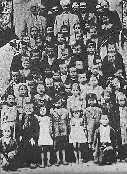
Quando a região ficou sob controle grego após a Conferência de Londres de 1912-1913, sua população incluía gregos, albaneses, arromenos e ciganos.
O censo grego contou os Chams muçulmanos separadamente de seus equivalentes cristãos; como resultado do sistema de classificação religiosa em vigor na Grécia, alguns dos Chams muçulmanos foram colocados ao lado de turcos muçulmanos que viviam na Grécia e foram transferidos para a Turquia durante a troca populacional de 1923 entre a Grécia e a Turquia[53] enquanto suas propriedades foram expropriadas pelo governo grego como parte do mesmo acordo.[54] Os albaneses Cham ortodoxos foram contados como gregos, e sua língua e herança albanesa estavam sob forte pressão de assimilação.[55] A região foi então temporariamente colonizada por refugiados gregos da Ásia Menor que foram usados como uma ferramenta demográfica para pressionar os Chams muçulmanos a deixar a área; a maioria desses gregos foi posteriormente transferida para outras áreas do país depois que a Grécia decidiu não enviar Chams albaneses muçulmanos em massa para a Turquia na década de 1920.[56]
Na década de 1930, a população da região era de aproximadamente 70.000; os muçulmanos de língua albanesa foram estimados em cerca de 18.000 a 20.000. Toda a população, independentemente da religião ou etnia, era chamada de Chams, mas não era contada como tal no censo grego.[57] (De acordo com o censo de 1928, a população muçulmana total na Grécia era de 126.017[58]).
Durante o período entreguerras, o topônimo Chameria era de uso comum na região[59] e também era o nome oficial da área acima do rio Acheron usado em todos os documentos governamentais pelo estado grego.[60] Em 1936, o estado grego criou uma nova prefeitura chamada Thesprotia, a partir de partes das prefeituras de Ioannina e Preveza, para exercer melhor controle sobre a minoria muçulmana albanesa Cham.[61]
Durante a ocupação da Grécia pelo Eixo (1941–1944), grandes partes da comunidade muçulmana Cham colaboraram com as forças italianas e alemãs[62] uma vez que as forças do Eixo manipularam a questão Cham para encorajar uma resistência benéfica ao domínio grego na região.[63] No início da década de 1940, 1.800 recrutas Cham foram desarmados pelas forças gregas e colocados para realizar trabalhos forçados em melhorias de infraestrutura, e todos os homens albaneses que ainda não haviam sido recrutados foram deportados para campos de internamento ou colocados no exílio nas ilhas gregas.[64]
No final da Segunda Guerra Mundial, os albaneses Cham foram sistematicamente expulsos da região pelas forças de guerrilha da Liga Nacional Republicana Grega (EDES), de direita, liderada por Napoleão Zervas.[66][67] Alguns Chams muçulmanos que formaram o Batalhão Chameria forneceram apoio militar às forças de resistência de esquerda do Exército de Libertação do Povo Grego (ELAS). Depois que os albaneses Cham se recusaram a lutar contra o ELAS, Zervas ordenou um ataque em massa às aldeias Cham por forças que consistiam principalmente de EDES e camponeses gregos locais ansiosos para se vingar da minoria mais rica de albaneses Cham.[68]
Um antigo membro da Chameria na Organização das Nações e Povos Não Representados (UNPO), através da organização Fundação Democrática da Chameria, foi admitido em 8 de junho de 2015. A filiação foi suspensa em dezembro de 2019.[69][70]
Demografia

Desde a Idade Média, a população da região de Chameria era de etnia mista e complexa, com uma indefinição de identidades de grupo, como albaneses e gregos, além de muitos outros grupos étnicos. Informações sobre a composição étnica da região ao longo de vários séculos são quase inexistentes, com forte probabilidade de que não se enquadrassem nos padrões "nacionais" padrão, como pretendiam os movimentos nacionalistas revolucionários do século XIX.
Histórica
No início do século XIX, o estudioso grego e secretário do governante otomano local Ali Paxá, Athanasios Psalidas, afirmou que Chameria era habitada por gregos e albaneses. Estes últimos estavam divididos entre cristãos e muçulmanos, enquanto os gregos eram o elemento dominante de Chameria.[71] Um censo populacional otomano realizado em 1908 registrou um total de 73.000 habitantes em Chameria, dos quais 93% eram albaneses.[72]
Nos censos gregos, apenas os muçulmanos da região eram contados como albaneses. De acordo com o censo grego de 1913, 25.000 muçulmanos viviam na época na região de Chameria[73] que tinham o albanês como língua materna, de uma população total de cerca de 60.000, enquanto em 1923 havia 20.319 muçulmanos chams. No censo grego de 1928, havia 17.008 muçulmanos que o tinham como língua materna. Durante o período entre guerras, o número de falantes de albanês nos censos oficiais de grego variou e flutuou, devido a motivos políticos e manipulação.[74]
Uma estimativa feita pelas forças de ocupação italianas durante a Segunda Guerra Mundial (1941) incluiu comunidades ortodoxas de etnia albanesa. De acordo com isso, na região viviam 54.000 albaneses, dos quais 26.000 ortodoxos, 28.000 muçulmanos e 20.000 gregos.[75] Após a guerra, de acordo com censos gregos onde grupos etnolinguísticos foram contados, os Chams muçulmanos eram 113 em 1947 e 127 em 1951. No mesmo censo grego de 1951, 7.357 falantes de albanês ortodoxo foram contados em todo o Épiro.[76]
| Ano | Muçulmanos[77] | Ortodoxos de língua albanesa | Muçulmanos e ortodoxos de língua albanesa | Ortodoxos de língua grega | Ortodoxo de língua arromena | População total | Fonte |
|---|---|---|---|---|---|---|---|
| 1908, para a definição menor da histórica Chameria[78] | 34.406 | 11.662 | 46.068 | 28.676 | 250[79] | 74.844 | Estatísticas de Amadori Virgili, apresentadas pela "União Pan-Epirótica da América" para a conferência de paz de Paris.[80] |
| 1908, para uma definição mais ampla da Chameria histórica[81] | 42.174 | 14.162 | 56.336 | 134.054 | 11.050[79] | 201.440 | Estatísticas de Amadori Virgili, apresentadas pela "União Pan-Epirótica da América" para a conferência de paz de Paris.[80] |
| Ano | Albaneses muçulmanos | Ortodoxos falantes de albanês | Número total
de falantes de albanês |
População total | Fonte |
|---|---|---|---|---|---|
| 1913 | 25.000 | --- | Desconhecido | 59.000 | Censo grego[82] |
| 1923 | 20.319 | --- | Desconhecido | 58.780 | Censo grego[83] |
| 1925 | 25.000 | --- | 25.000 | 58.000 | Governo albanês[83][84] |
| 1928 | 17.008 | --- | Desconhecido | 68.200 | Censo grego (número de muçulmanos no Épiro) [83] |
| 1938 | 17.311 | --- | Desconhecido | 71.000 | Governo grego[83] |
| 1940 | 21.000–22.000 | --- | Desconhecido | 72.000 | Estimativa sobre o censo grego[83] |
| 1941 | 28.000 | 26.000 | 54.000 | Estimativa italiana (pelas forças de ocupação do Eixo durante a Segunda Guerra Mundial) [83] | |
| 1947 | 113 | --- | Desconhecido | Censo grego[83] | |
| 1951 | 127 | --- | Desconhecido | Censo grego.[83] 7.357 falantes de albanês ortodoxo também foram contados em todo o Épiro.[85] |
Atualmente
Com exceção da parte de Chameria que fica na Albânia, Chameria era habitada principalmente por gregos no final da Segunda Guerra Mundial,[86] e da subsequente assimilação dos Chams restantes. O número de albaneses étnicos que ainda residem na região de Chameria é incerto, uma vez que o governo grego não inclui categorias étnicas e linguísticas em nenhum censo oficial.
Muçulmanos
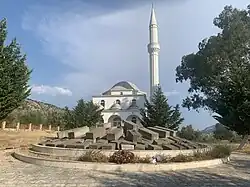
O censo grego de 1951 contou um total de 127 Chams albaneses muçulmanos no Épiro.[87] Em anos mais recentes (1986), 44 membros desta comunidade são encontrados em Thesprotia, localizada nos assentamentos de Sybota, Kodra e Polyneri (anteriormente Koutsi).[88] Além disso, até recentemente a comunidade muçulmana em Polyneri era a única no Épiro a ter um imã.[89] A mesquita da aldeia foi a última na área antes de ser explodida por um cristão local em 1972.[89] O número de Chams muçulmanos restantes na área após a Segunda Guerra Mundial incluiu também pessoas que se converteram à Ortodoxia e foram assimiladas pela população local a fim de preservar suas propriedades e a si mesmas.[90][91][92]
Cristãos ortodoxos
De acordo com um estudo do projeto Euromosaic da União Europeia, comunidades de língua albanesa vivem ao longo da fronteira com a Albânia na prefeitura de Thesprotia, na parte norte da prefeitura de Preveza na região chamada Thesprotiko e algumas aldeias na unidade regional de Ioannina.[93] A língua albanesa ainda é falada por uma minoria de habitantes em Igoumenitsa.[94] No norte da prefeitura de Preveza, essas comunidades também incluem a região de Fanari,[95] em aldeias como Ammoudia[96] e Agia.[97] Em 1978, alguns dos habitantes mais velhos dessas comunidades eram monolíngues albaneses. Os mais jovens também falavam albanês, pois quando membros da população local em idade ativa migraram para Atenas ou para o exterior em busca de oportunidades de emprego, as crianças foram deixadas com seus avós, criando assim uma continuidade de falantes.[98]
Hoje, essas comunidades ortodoxas de língua albanesa se referem a si mesmas como arvanitas na língua grega e se autoidentificam como gregas, como as comunidades arvanitas no sul da Grécia.[99] Eles se referem à sua língua em grego como Arvanitika e quando conversam em albanês como Shqip.[100][101] Em contraste com os arvanitas, alguns mantiveram uma identidade linguística[102] e étnica distinta, mas também uma identidade nacional albanesa.[103] Na presença de estrangeiros, há uma relutância maior entre os falantes ortodoxos de albanês em falar albanês, em comparação com os arvanitas em outras partes da Grécia.[104] Entre aqueles que são descendentes de Chams, uma relutância em se declarar como tal foi notada.[105] O pesquisador Tom Winnifirth concluiu que era impossível encontrar falantes de albanês nas principais cidades da região, assumindo que pode haver um número em algumas aldeias do interior.[106] e concluiu nos anos posteriores que o albanês havia "praticamente desaparecido" na região principalmente devido ao fato de a língua ser desencorajada e proibida.[107] De acordo com o Ethnologue, a população de língua albanesa do Épiro grego e da Macedônia Ocidental grega é de 10.000.[108] De acordo com a autora Miranda Vickers, os Chams ortodoxos somavam aproximadamente 40.000 pessoas em 1999.[109] Entre alguns arvanitas gregos, como os da aldeia de Kastri perto de Igoumentisa, houve um renascimento no folclore, particularmente na realização do "casamento arvanítico".[110]
Ver também
- Albaneses Chams
- Questão Cham
- Nacionalismo albanês
Notas
- ↑ Também chamada de Chameria ou Chaméria.
Referências
- ↑ a b Elsie, Robert and Bejtullah D. Destani (2012). The Cham Albanians of Greece: A Documentary History. IB Tauris. ISBN 978-1-780760-00-1. p. XXIX. "Chameria is a mountainous region of the southwestern Balkan Peninsula that now straddles the Greek-Albanian border. Most of Chameria is in the Greek Province of Epirus, corresponding largely to the prefectures of Thesprotia and Preveza, but it also includes the southernmost part of Albania, the area around Konispol. It is approximately 10,000 square kilometres in size and has a current, mostly Greek-speaking population of about 150,000. As an historical region, Chameria, also spelled Chamuria, Chamouria or Tsiamouria, is sometimes confused with Epirus which is in fact a much larger area that includes more inland territory in northwestern Greece, for example, the town of Janina/loannina, and also much of southern Albania. Geographically speaking, Chameria begins to the north at the rivers Pavlle and Shalës in the southern part of Albania. It stretches southwards along the Ionian coastline in Greece down to Preveza and the Gulf of Arta, which in the nineteenth century formed the border between Albania and Greece. It does not include the island of Corfu or the region of Janina to the east. The core or central region of Chameria, known in Greek as Thesprotia, could be said to be the basins of the Kalamas and Acheron Rivers. It was the Kalamas River, known in ancient times as the 'Thyamis, that gave Chameria its name."
- ↑ Gawrych, George (2006). The Crescent and the Eagle: Ottoman rule, Islam and the Albanians, 1874–1913. London: IB Tauris. 23 páginas. ISBN 9781845112875 "According to the Ottoman administrative system of the 1880s, Albanians claimed Toskalık or Toskland as encompassing the sancaks of Ergiri, Preveze, Berat and Yanya in the province of Yanya and the sancaks of Görice, Manastir, and Elbasan in the province of Manastir. Toskalık also divided into three parts, Toskalık, Laplık and Çamlık... Chamland (Çamlık) encompassed Margalic, Aydonat, and Filat."
- ↑ Baltsiotis, Lambros (2011). «The Muslim Chams of Northwestern Greece: The grounds for the expulsion of a "non-existent" minority community». European Journal of Turkish Studies. European Journal of Turkish Studies. Social Sciences on Contemporary Turkey (12). doi:10.4000/ejts.4444
 para. 5-6. "During the beginning of the 20th Century, the northwestern part of the Greek region of Epirus was mostly populated by an Albanian-speaking population, known under the ethnonyme "Chams" [Çamë, Çam (singular)in Albanian, Τσ(ι)άμηδες, Τσ(ι)άμης in Greek]. The Chams are a distinct ethno-cultural group which consisted of two integral religious groups: Orthodox Christians and Sunni Muslims. This group lived in a geographically wide area, expanding to the north of what is today the Preveza prefecture, the western part of which is known as Fanari [Frar in Albanian], covering the western part of what is today the prefecture of Thesprotia, and including a relatively small part of the region which today constitutes Albanian territory. These Albanian speaking areas were known under the name Chamouria [Çamëri in Albanian, Τσ(ι)αμουριά or Τσ(ι)άμικο in Greek]."
- ↑ Hartmann, Elke (2016). Die Reichweite des Staates: Wehrpflicht und moderne Staatlichkeit im Osmanischen Reich 1869-1910. [S.l.]: Verlag Ferdinand Schöningh. 118 páginas. ISBN 9783657783731 "Die kazas Filat, Aydonat, Margiliç und die Stadt Parga bildeten seit 1909 einen eigenen sancak Çamlak."
- ↑ Hammond, Nicholas (1967). Epirus: the Geography, the Ancient Remains, the History and Topography of Epirus and Adjacent Areas. Clarendon Press. ISBN 9780198142539. p.27. "The present distribution of the Albanian-speaking villages bears little relation to the frontier which was drawn between Greece and Albania after the First World War. In Map 2 I have shown most of the Greek speaking villages in Albanian Epirus and some of the Albanian-speaking villages in Greek Epirus. The map is based on observations made by Clarke and myself during our travels between 1922 and 1939."; p.27. "This wave extended further down the coast into the low-lying area of the Kalamas, the Tsamouria."; p. 28. "Tsamouria is a word which..... Clarke and I were both familiar with it, and it was in common use."; p.50. "Loutsa lies on a saddle of the ridge, which forms the watershed between the Acheron plain and the streams running south-west into the sea, and it is the most southerly of the villages of Tsamouria, the Albanian speaking area of which Margariti and Paramythia are centres."; p.76. "The canton of Margariti. This canton forms the heart of the Tsamouria, the region of Albanian-speaking villages."
- ↑ Baltsiotis. The Muslim Chams of Northwestern Greece. 2011. footnote 2. "In certain sources Chamouria includes the Greek-speaking area to the east of the city of Filiati and does not include the Albanian speaking area of Fanari, named alternatively "Prevezaniko". The official name of the area north of the Acheron river is Chamouria in all Greek state documents for the whole Interwar period."
- ↑ a b Kretsi, Georgia.The Secret Past of the Greek-Albanian Borderlands. Cham Muslim Albanians: Perspectives on a Conflict over Historical Accountability and Current Rights in Ethnologica Balkanica, Vol. 6, p. 173: "Even more accentuated in the immediate post-socialist era, the regional denomination "Chameria" is primarily in use by Albanians with obvious irredentist undertones which refer to an "ethnic Albanian territory" which today remains inside Greek territory..."
- ↑ The Greek encyclopedia "Papyrus-Larousse" (Πάπυρος-Λαρούς), c.1965 defines "Tsamouria" (article "Τσαμουριά") as "The older name ... of the modern area of Thesprotia" and directs to article "Thesprotia" (Θεσπρωτία).
- ↑ Balkan Studies By Hetaireia Makedonikōn Spoudōn. Hidryma Meletōn Cheresonēsou tou Haimou. Published by Institute for Balkan Studies, Society for Macedonian Studies., 1976
- ↑ NGL Hammond, Epirus: The Geography, the Ancient Remains, the History and Topography of Epirus and Adjacent Areas, Published by Clarendon P., 1967, p. 31
- ↑ Orel Vladimir, Albanian etymological dictionary, Brill, 1998, pp 49, 50.
- ↑ a b Kornrumpf, Hans-Jurgen (1984). «Der Sandschak Camlik. Anmerkingen zu einem Kurzlebigen Spatosmanischen Verwalitungsbezirk». Balcanica (15): 122
- ↑ Miranda Vickers, The Albanians: A Modern History, I.B.Tauris, 1999, ISBN 978-1-86064-541-9, p. 113
- ↑ Christoforos Perraivos, "War Memoirs", (Χριστόφορος Περραιβός, "Απομνημονεύματα πολεμικά"), 1836, vol. 1, p. 124, down.
- ↑ Pouqueville, François Charles Hugues Laurent (1822). Travels in Southern Epirus, Acarnania, Aetolia, Attica, and Peloponesus: Or the Morea, &c. &c. in the Years 1814-1816 (em inglês). [S.l.]: Sir R. Phillips and Company
- ↑ William Martin Leake (1835). Travels in Northern Greece. volume IV. J. Rodwell. pp. 71-72. The plain near the mouth of the Kalamá, is called Rai, and the river forms the line of separation between the two subdivisions of Tjámi (Græcè, Τζαμουριά), named Dághawi, or Dai, and Parakálamo. Dághawi comprehends the country from the Kalamá southward as far as the bounds of Paramythía, and Fanári; Parakálamo, that in the opposite direction to the boundaries of Vutzintró and Délvino. In Dághawi are Griko-khóri, Gomenítza, and Nista, situated in that order from south to north on the hills above the bay of Gomenítza: Gravá, in the plain near the mouth of the Kalamá. Between Gomenítza and Menína, which stands on the left bank of the Kalamá, in the road from Paramythía to Filiátes, are several Musulman villages, of which the principal are Súliasi, Varfaniús, and Rizaniús: to these belongs the plain of the Lower Kalamá to the left of the river. A high cliff at Zuliána, in a line between Paramythía and Fillátes, forms a very conspicuous object from Corfú."
- ↑ Kokolakis, Mihalis (2003). Το ύστερο Γιαννιώτικο Πασαλίκι: χώρος, διοίκηση και πληθυσμός στην τουρκοκρατούμενη Ηπειρο (1820-1913) The late Pashalik of Ioannina: Space, administration and population in Ottoman Epirus (1820-1913). EIE-ΚΝΕ. p.373.
- ↑ Elias G Skoulidas (22 February 2011). Identities, Locality and Otherness in Epirus during the Late Ottoman period.(doc). European Society of Modern Greek studies. p. 7. Retrieved 27 October 2015. "Nikolaos Konemenos takes a different approach, by not denying his Albanian identity, although he participated in Greek public life. He accepts this identity and embodies it, without excluding the other identity: κι εγώ είμαι φυσικός Αρβανίτης, επειδή κατάγομαι από τα' χωριά της Λάκκας (Τσαμουριά) και είμαι απόγονος ενός καπετάν Γιώργη Κονεμένου 'λ που εμίλειε τα' αρβανίτικα κι όπου ταις αρχαίς του προπερασμένου αιώνος... είχε καταιβεί κι είχε αποκατασταθεί στην Πρέβεζα...[I too am a natural Albanian, because I originate from the villages of Lakka (Tsamouria) and I'm a descendant of a kapetan Giorgis Konemenos, who spoke Albanian and who at the beginning of the last century... had come down and had settled in Preveza]. The spelling mistakes in this passage are a good indicator of what is happening."
- ↑ a b c Chirol, Valentine (1881). Twixt Greek and Turk. W Blackwood & sons. pp. 231-232. "The limits of the Albanian-speaking districts of Epirus south of the Kalamas may be roughly defined as follows: Starting from the Kalamas near the sharp bend which that river takes to the north at the foot of Mount Lubinitza, they follow the crest of the amphitheatrical range of Suli as far as the gorge of the Acheron. In that neighbourhood, probably owing to the influence which the Suliote tribe at one time enjoyed, they drop over to the east into the valley of the Luro, and follow its basin as far as the peninsula on which Prevesa, is situated, where the Greek element resumes its preponderancy. Within these outer limits of the Albanian tongue the Greek element is not unrepresented, and in some places, as about Paramythia, for instance, it predominates; but, on the whole, the above- defined region may be looked upon as essentially Albanian. In this, again, there is an inner triangle which is purely Albanian—viz., that which lies between the sea and the Kalamas on the one hand and the waters of the Vuvo on the other. With the exception of Parga and one or two small hamlets along the shore, and a few Greek chifligis on Albanian estates, the inhabitants of this country are pure Tchamis—a name which, notwithstanding Von Hahn's more elaborate interpretation. I am inclined to derive simply from the ancient appellation of the Kalamas, the Thyamis, on both banks of which stream the Albanian tribe of the Tchamis, itself a subdivision of the Tosks, has been settled from times immemorial. From the mountain fastnesses which enclose this inner triangle, the Tchamis spread out and extended their influence east and south; and the name of Tchamouria, which is especially applied to the southernmost Albanian settlements in Epirus, was probably given to that district by themselves as an emphatic monument of their supremacy; but it cannot belong less rightfully to the centre, where they hold undivided sway."
- ↑ a b Gawrych, George (2006). The Crescent and the Eagle: Ottoman rule, Islam and the Albanians, 1874–1913. London: IB Tauris. 23 páginas. ISBN 9781845112875 "According to the Ottoman administrative system of the 1880s, Albanians claimed Toskalık or Toskland as encompassing the sancaks of Ergiri, Preveze, Berat and Yanya in the province of Yanya and the sancaks of Görice, Manastir, and Elbasan in the province of Manastir. Toskalık also divided into three parts, Toskalık, Laplık and Çamlık... Chamland (Çamlık) encompassed Margalic, Aydonat, and Filat."
- ↑ Kokolakis, Mihalis (2003). Το ύστερο Γιαννιώτικο Πασαλίκι: χώρος, διοίκηση και πληθυσμός στην τουρκοκρατούμενη Ηπειρο (1820-1913) The late Pashalik of Ioannina: Space, administration and population in Ottoman Epirus (1820-1913). EIE-ΚΝΕ. p.373.
- ↑ Frashëri, Sami. "Description of Chameria". Retrieved 27 October 2015. "Description of Chameria... This dictionary contains numerous entries on the towns and regions of Chameria or southern Epirus... Janina [Ioannina]... Konica [Konitza]... Lurus [Louros]... "This town is also known as Paramythia. It is a kasaba and the capital of a kaza in the Vilayet and Sandjak of Janina that is situated in Chameria, the southeastern part of Albania... Filati.This is a kasaba and the capital of a kaza in the territory of Albanian Chameria... Parga.This is a kasaba and the capital of a nahiye on the southern coast of Albania, in the Vilayet of Janina, Sandjak of Preveza and the kaza of Margëlliç. Although ships cannot dock here, it is the chief port of Chameria, with sailing ships coming and going to Corfu and Trieste and conducting much trade. The nahiye of Parga includes the central part of the plain of Chameria and belongs to the kaza of Margëlliç... Preveza.This is a kasaba in southern Albania, to the west of Arta. It is situated in the Vilayet of Janina and is a sandjak of the same name and a centre of Chameria... Sandjak of Preveza.This is the smallest of the sandjaks in the Vilayet of Janina. It is situated in the southern corner of Albania and forms the southern half of Chameria. It borders to the north on the Sandjak of Janina, to the east on Greece, to the south on Arta and the channel of Preveza, and to the west and southwest on the Greek Sea."
- ↑ a b Hammond, Nicholas (1967). Epirus: the Geography, the Ancient Remains, the History and Topography of Epirus and Adjacent Areas. Clarendon Press. ISBN 9780198142539. p.27. "The present distribution of the Albanian-speaking villages bears little relation to the frontier which was drawn between Greece and Albania after the First World War. In Map 2 I have shown most of the Greek speaking villages in Albanian Epirus and some of the Albanian-speaking villages in Greek Epirus. The map is based on observations made by Clarke and myself during our travels between 1922 and 1939."; p.27. "This wave extended further down the coast into the low-lying area of the Kalamas, the Tsamouria."; p. 28. "Tsamouria is a word which..... Clarke and I were both familiar with it, and it was in common use."; p.50. "Loutsa lies on a saddle of the ridge, which forms the watershed between the Acheron plain and the streams running south-west into the sea, and it is the most southerly of the villages of Tsamouria, the Albanian speaking area of which Margariti and Paramythia are centres."; p.76. "The canton of Margariti. This canton forms the heart of the Tsamouria, the region of Albanian-speaking villages."
- ↑ a b Drandakis Pavlos (editor), Great Greek Encyclopedia, vol. 23, article Tsamouria. Editions "Pyrsos", 1936–1934, in Greek language.
- ↑ a b Baltsiotis. The Muslim Chams of Northwestern Greece. 2011. footnote 2. "In certain sources Chamouria includes the Greek-speaking area to the east of the city of Filiati and does not include the Albanian speaking area of Fanari, named alternatively "Prevezaniko". The official name of the area north of the Acheron river is Chamouria in all Greek state documents for the whole Interwar period."
- ↑ a b Michalopoulos, Dimitris (1 de janeiro de 1986). «The moslems of Chamuria and the exchange of populations between Greece and Turkey». Balkan Studies (em inglês). 27 (2): 303–313. ISSN 2241-1674. Consultado em 30 de junho de 2017
- ↑ E. Manta, Ματιές στην Ιστορία: Τσάμηδες και Tσαμουριά: "Τσαμουριά ονομάζεται η περιοχή εκείνη της Ηπείρου, που εκτείνεται κατά μήκος της ακτής ανάμεσα στις εκβολές του ποταμού Αχέροντα και μέχρι το Βουθρωτό και ανατολικά μέχρι τους πρόποδες του όρους Ολύτσικας (Τόμαρος). Η περιοχή ταυτίζεται με τη Θεσπρωτία και ένα μικρό της τμήμα ανήκει σήμερα στην Αλβανία με κέντρο την κωμόπολη Κονίσπολη."
- ↑ Kentriotis Kyriakos, Der Verlauf der Griechisch-Albanischen Beziehungen nach dem Zweiten WEeltkrieg und die Frage der Muslimischen Tschamen, Institute for Balkan Studies, p. 19-20: "Çamëria hieß jene Gegend von Epirus, die sich an der Küste entlang zwischen der Mündung des Acheron bis nach Butrint"
- ↑ Kallivretakis, Leonidas (1995). "Η ελληνική κοινότητα της Αλβανίας υπό το πρίσμα της ιστορικής γεωγραφίας και δημογραφίας [The Greek Community of Albania in terms of historical geography and demography." In Nikolakopoulos, Ilias, Kouloubis Theodoros A. & Thanos M. Veremis (eds). Ο Ελληνισμός της Αλβανίας [The Greeks of Albania]. University of Athens. p. 51. "AM Αλβανοί Μουσουλμάνοι" p. 36: "II περιφέρεια της Τσαμουριάς υπαγόταν στα τέλη του περασμένου αιώνα... Η χάραξη της οριστικής ελληνοαλβανικής μεθορίου, το Νοέμβριο του 1921, διαιρώντας την Ήπειρο στα δύο, διαίρεσε και την Τσαμουριά μεταξύ Αλβανίας (Νομός Δελβίνου & Αγίων Σαράντα) και Ελλάδας (σημερινός Νομός Θεσπρωτίας)."
- ↑ Kretsi, Georgia (2002). «in an area which today is called Thesprotia in Greek and Chameria in Albanian (as well as in seven villages on the Albanian side of the border).». LIT Verlag Münster. Ethnologia Balkanica (em inglês). 6: 173. Consultado em 29 de junho de 2017
- ↑ Baltsiotis, Lambros (2011). «The Muslim Chams of Northwestern Greece: The grounds for the expulsion of a "non-existent" minority community». European Journal of Turkish Studies. European Journal of Turkish Studies. Social Sciences on Contemporary Turkey (12). doi:10.4000/ejts.4444 para. 5-6. "During the beginning of the 20th Century, the northwestern part of the Greek region of Epirus was mostly populated by an Albanian-speaking population, known under the ethnonyme "Chams" [Çamë, Çam (singular)in Albanian, Τσ(ι)άμηδες, Τσ(ι)άμης in Greek]. The Chams are a distinct ethno-cultural group which consisted of two integral religious groups: Orthodox Christians and Sunni Muslims. This group lived in a geographically wide area, expanding to the north of what is today the Preveza prefecture, the western part of which is known as Fanari [Frar in Albanian], covering the western part of what is today the prefecture of Thesprotia, and including a relatively small part of the region which today constitutes Albanian territory. These Albanian speaking areas were known under the name Chamouria [Çamëri in Albanian, Τσ(ι)αμουριά or Τσ(ι)άμικο in Greek]."
- ↑ Baltsiotis. The Muslim Chams of Northwestern Greece. 2011. footnote 2. "In certain sources Chamouria includes the Greek-speaking area to the east of the city of Filiati and does not include the Albanian speaking area of Fanari, named alternatively "Prevezaniko". The official name of the area north of the Acheron river is Chamouria in all Greek state documents for the whole Interwar period."
- ↑ Meyer, Hermann Frank (2008). Blutiges Edelweiß: Die 1. Gebirgs-Division im Zweiten Weltkrieg [Bloodstained Edelweiss. The 1st Mountain-Division in WWII] (em alemão). [S.l.]: Ch. Links Verlag. 464 páginas. ISBN 978-3-86153-447-1
- ↑ Hart, Laurie Kain (fevereiro de 1999), «Culture, Civilization, and Demarcation at the Northwest Borders of Greece», Blackwell Publishing, American Ethnologist, 26 (1), doi:10.1525/ae.1999.26.1.196 "Like the Greeks, they made territorial demands, claiming for themselves, on the grounds of a majority Albanian-speaking Muslim population, the district of Chameria (or Tsamouria, that is, Epiros at least as far south as Preveza) and the (largely Vlach) Pindus."
- ↑ Tsitselikis, Konstantinos (2012). Old and New Islam in Greece: From Historical Minorities to Immigrant Newcomers (em inglês). [S.l.]: Martinus Nijhoff Publishers. ISBN 978-9004221529
- ↑ Delvina, Sherif (2006). Low Albania (Epirus) and Cham issue (em inglês). [S.l.]: Pub. House "Eurorilindja". ISBN 9789994386109. OCLC 124184965
- ↑ Vickers, Miranda; Pettifer, James (1997). Albania: From anarchy to a Balkan identity. Washington Square: New York University Press. pp. 207. ISBN 9781850652908 Verifique o valor de
|url-access=registration(ajuda) "The region of Chameria extends from the Ionian coast to the Ioannina mountains in the east, and in the south almost as far as the Preveza gulf." - ↑ Vickers, Miranda. «The Cham Issue» (PDF). Conflict Studies Research Centre. Consultado em 29 de junho de 2017
- ↑ a b Elsie, Robert and Bejtullah D. Destani (2012). The Cham Albanians of Greece: A Documentary History. IB Tauris. ISBN 978-1-780760-00-1. p. XXIX. "Chameria is a mountainous region of the southwestern Balkan Peninsula that now straddles the Greek-Albanian border. Most of Chameria is in the Greek Province of Epirus, corresponding largely to the prefectures of Thesprotia and Preveza, but it also includes the southernmost part of Albania, the area around Konispol. It is approximately 10,000 square kilometres in size and has a current, mostly Greek-speaking population of about 150,000. As an historical region, Chameria, also spelled Chamuria, Chamouria or Tsiamouria, is sometimes confused with Epirus which is in fact a much larger area that includes more inland territory in northwestern Greece, for example, the town of Janina/loannina, and also much of southern Albania. Geographically speaking, Chameria begins to the north at the rivers Pavlle and Shalës in the southern part of Albania. It stretches southwards along the Ionian coastline in Greece down to Preveza and the Gulf of Arta, which in the nineteenth century formed the border between Albania and Greece. It does not include the island of Corfu or the region of Janina to the east. The core or central region of Chameria, known in Greek as Thesprotia, could be said to be the basins of the Kalamas and Acheron Rivers. It was the Kalamas River, known in ancient times as the 'Thyamis, that gave Chameria its name."
- ↑ Elsie, Robert & Bejtullah Destani, 2012, p. 409
- ↑ Giakoumis, Konstantinos (2003), Fourteenth-century Albanian migration and the ‘relative autochthony’ of the Albanians in Epeiros. The case of Gjirokastër." Byzantine and Modern Greek Studies. 27. (1), p. 176-177: "The presence of Albanians in the Epeirote lands from the beginning of the thirteenth century is also attested by two documentary sources: the first is a Venetian document of 1210, which states that the continent facing the island of Corfu is inhabited by Albanians; and the second is letters of the Metropolitan of Naupaktos John Apokaukos to a certain George Dysipati, who was considered to be an ancestor of the famous Shpata family.... Are we obliged to see a possible earlier Albanian migration in the Epirote lands... I believe that the use of hypothetical immigrations as a basis to interpret sources that indicate the presence of Albanians in the Epeirote lands prior to the thirteenth-fourteenth century is somewhat arbitrary.... the immigration movements of the fourtheenth century are documented fact."
- ↑ Giakoumis, Konstantinos (2003), p. 177
- ↑ John Van Antwerp Fine (1994). The Late Medieval Balkans: A Critical Survey from the Late Twelfth Century to the Ottoman Conquest. [S.l.]: University of Michigan Press. ISBN 978-0-472-08260-5
- ↑ John Van Antwerp Fine (1994). The Late Medieval Balkans: A Critical Survey from the Late Twelfth Century to the Ottoman Conquest. [S.l.]: University of Michigan Press. pp. 349–350. ISBN 978-0-472-08260-5
- ↑ John Van Antwerp Fine (1994). The Late Medieval Balkans: A Critical Survey from the Late Twelfth Century to the Ottoman Conquest. [S.l.]: University of Michigan Press. pp. 350–357, 544, 563. ISBN 978-0-472-08260-5
- ↑ Balkan Studies By Hetaireia Makedonikōn Spoudōn. Hidryma Meletōn Cheresonēsou tou Haimou. Published by Institute for Balkan Studies, Society for Macedonian Studies., 1976
- ↑ Survey of International Affairs, By Arnold Joseph Toynbee, Veronica Marjorie Toynbee, Royal Institute of International Affairs. Published by Oxford University Press, 1958
- ↑ a b Giakoumis, Konstantinos (2010). "The Orthodox Church in Albania Under the Ottoman Rule 15th-19th Century." In Oliver Jens Schmitt (ed.). Religion und Kultur im albanischsprachigen Südosteuropa. Peter Lang. p. 85. "In the 18th century Islamization increased and a large number of inhabitants of Labëri, Filiates, Pogon and Kurvelesh converted."; p. 86. "In 1739, twenty five villages in Thesprotia were forced to convert to Islam en masse. It has also been noted that conversions intensified after the wars of Russia with the Porte (1710-1711, 1768-1774, 1787-1792, 1806-1812)."
- ↑ Fleming, Katherine Elizabeth. The Muslim Bonaparte: Diplomacy and Orientalism in Ali Pasha's Greece. Princeton University Press, 1999, ISBN 0-691-00194-4, p. 59.
- ↑ a b Barbara Jelavich. History of the Balkans: Eighteenth and nineteenth centuries. Cambridge University Press, 1983. ISBN 978-0-521-27458-6
- ↑ a b Baltsiotis. The Muslim Chams of Northwestern Greece. 2011. "The Albanian-speaking, Orthodox population did not share the national ideas of their Muslim neighbors and remained Greek-oriented, identifying themselves as Greeks."
- ↑ Hartmann, Elke (2016). Die Reichweite des Staates: Wehrpflicht und moderne Staatlichkeit im Osmanischen Reich 1869-1910. [S.l.]: Verlag Ferdinand Schöningh. 118 páginas. ISBN 9783657783731 "Die kazas Filat, Aydonat, Margiliç und die Stadt Parga bildeten seit 1909 einen eigenen sancak Çamlak."
- ↑ Kristin Fabbe. "Defining Minorities and Identities – Religious Categorization and State-Making Strategies in Greece and Turkey". Presentation at: The Graduate Student Pre-Conference in Turkish and Turkic Studies, University of Washington, October 18, 2007.
- ↑ Ktistakis, Yiorgos. "Τσάμηδες – Τσαμουριά. Η ιστορία και τα εγκλήματα τους" [Chams – Chameria. Their History and Crimes], Paramythia Online Arquivado em 2010-04-12 no Wayback Machine.
- ↑ Dimitri Pentzopoulos, The Balkan Exchange of Minorities and Its Impact on Greece, C. Hurst & Co. Publishers, 2002, ISBN 978-1-85065-674-6, p. 128
- ↑ Baltsiotis. The Muslim Chams of Northwestern Greece. 2011. "Two years earlier, Greek refugees from Asia Minor had been settled in the area. These newcomers were used as a tool for applying more pressure against Muslims for them to decide to leave Greece. The newcomers took advantage of the land expropriations, and settled in the houses of Muslims. These actions were in accordance with legal provisions applicable to the whole territory of Greece.61 It is highly probable, therefore, that some Muslims, pressed by the legislation relating to expropriation and the presence of refugees who presented a threat to them, sold their estates and remained landless. ... [Note 61] The great majority of the refugees were resettled when it was decided that the Muslim population would not be exchanged."
- ↑ Drandakis Pavlos (editor), Great Greek Encyclopedia, vol. 23, article Tsamouria. Editions "Pyrsos", 1936–1934, in Greek language, p. 405
- ↑ Great Greek Encyclopedia, vol. 10, p. 236. Anemi.lib.uoc.gr. Retrieved on 2014-02-01.
- ↑ Hammond, Nicholas (1967). Epirus: the Geography, the Ancient Remains, the History and Topography of Epirus and Adjacent Areas. Clarendon Press. ISBN 9780198142539. p.27. "The present distribution of the Albanian-speaking villages bears little relation to the frontier which was drawn between Greece and Albania after the First World War. In Map 2 I have shown most of the Greek speaking villages in Albanian Epirus and some of the Albanian-speaking villages in Greek Epirus. The map is based on observations made by Clarke and myself during our travels between 1922 and 1939."; p.27. "This wave extended further down the coast into the low-lying area of the Kalamas, the Tsamouria."; p. 28. "Tsamouria is a word which..... Clarke and I were both familiar with it, and it was in common use."; p.50. "Loutsa lies on a saddle of the ridge, which forms the watershed between the Acheron plain and the streams running south-west into the sea, and it is the most southerly of the villages of Tsamouria, the Albanian speaking area of which Margariti and Paramythia are centres."; p.76. "The canton of Margariti. This canton forms the heart of the Tsamouria, the region of Albanian-speaking villages."
- ↑ Baltsiotis. The Muslim Chams of Northwestern Greece. 2011. footnote 2. "In certain sources Chamouria includes the Greek-speaking area to the east of the city of Filiati and does not include the Albanian speaking area of Fanari, named alternatively "Prevezaniko". The official name of the area north of the Acheron river is Chamouria in all Greek state documents for the whole Interwar period."
- ↑ Baltsiotis. The Muslim Chams of Northwestern Greece. 2011. "Finally, so as to exercise better control over the minority, the Greek state created in late 1936 a new prefecture, that of Thesprotia, consisting of areas that previously belonged to the Prefectures of Ioannina (Yanina) and Preveza, embodying all the Muslim population.... According to the suggestion of the General Administration of Epirus to the Ministry of Foreign Affairs (24 October 1936), the presence of Albanian Muslims and the difficulties in "administrating" them from a far away capital calls for the creation of a new prefecture (HAMFA, 1937, A4/9)."
- ↑ Meyer, Hermann Frank (2008) (in German). Blutiges Edelweiß: Die 1. Gebirgs-Division im Zweiten Weltkrieg [Bloodstained Edelweiss. The 1st Mountain-Division in WWII]. Ch. Links Verlag. ISBN 978-3-86153-447-1. pp. 152, 204, 464, 705: "Die albanische Minderheit der Tsamides kollaborierte zu grossen Teilen mit den Italienern und den Deutschen. [The Albanian minority of the Chams collaborated in large parts with the Italians and the Germans]".
- ↑ Fabbe, Kristin (28 de março de 2019). Disciples of the State (em inglês). [S.l.]: Cambridge University Press. 159 páginas. ISBN 9781108419086
- ↑ Mazower, Mark. After The War Was Over: Reconstructing the Family, Nation and State in Greece, 1943–1960. Princeton University Press, 2000, ISBN 0-691-05842-3, pp. 25–26.
- ↑ «President Begaj honors the victims of Greek 'ethnic cleansing' against Albanians in Chameria». Top Channel. 15 de julho de 2024
- ↑ Fabbe, Kristin (28 de março de 2019). Disciples of the State (em inglês). [S.l.]: Cambridge University Press. 159 páginas. ISBN 9781108419086
- ↑ Baltsiotis, Lambros (13 de novembro de 2011). «The Muslim Chams of Northwestern Greece. The grounds for the expulsion of a "non-existent" minority community». European Journal of Turkish Studies. Social Sciences on Contemporary Turkey (em francês) (12). ISSN 1773-0546. doi:10.4000/ejts.4444
- ↑ Mazower, Mark. After The War Was Over: Reconstructing the Family, Nation and State in Greece, 1943–1960. Princeton University Press, 2000, ISBN 0-691-05842-3, pp. 25–26.
- ↑ «Members». UNPO. Consultado em 20 de junho de 2020
- ↑ «UNPO: Chameria». unpo.org. 6 de julho de 2017. Consultado em 24 de janeiro de 2019
- ↑ Kallivretakis, Leonidas (1995). "Η ελληνική κοινότητα της Αλβανίας υπό το πρίσμα της ιστορικής γεωγραφίας και δημογραφίας [The Greek Community of Albania in terms of historical geography and demography." In Nikolakopoulos, Ilias, Kouloubis Theodoros A. & Thanos M. Veremis (eds). Ο Ελληνισμός της Αλβανίας [The Greeks of Albania]. University of Athens. p. 12: "δίδασκε ο Αθανάσιος Ψαλίδας στις αρχές του 19ου αιώνα και συνέχιζε: «Κατοικείται από Γραικούς και Αλβανούς· οι πρώτοι είναι περισσότεροι», ενώ διέκρινε τους δεύτερους σε Αλβανούς Χριστιανούς και Αλβανούς Μουσουλμάνους"
- ↑ Gizem Bilgin, Aytaç (2020). Conflict areas in the Balkans. Lanham: Lexington Books. ISBN 9781498599207
- ↑ Dimitri Pentzopoulos, The Balkan Exchange of Minorities and Its Impact on Greece, C. Hurst & Co. Publishers, 2002, ISBN 978-1-85065-674-6, p. 128
- ↑ Baltsiotis. The Muslim Chams of Northwestern Greece. 2011. "In the official censuses of the Greek State in the Interwar period there is major manipulation involving the numbers of the Albanian speakers in the whole of the Greek territory.... The issue here is not the underestimation of the numbers of speakers as such, but the vanishing and reappearing of linguistic groups according to political motives, the crucial one being the "stabilization" of the total number of Albanian speakers in Greece."
- ↑ Ktistakis, Yiorgos. "Τσάμηδες – Τσαμουριά. Η ιστορία και τα εγκλήματα τους" [Chams – Chameria. Their History and Crimes], Paramythia Online Arquivado em 2010-04-12 no Wayback Machine.
- ↑ Baltsiotis. The Muslim Chams of Northwestern Greece. 2011. "The Orthodox Albanian-speakers' "return" to Southern Greece and Epirus, Macedonia and Thrace also present at this time, at the 1951 census (7,357 are counted in Epirus)."
- ↑ In the Ottoman census and the works of Amadore Virgili, Muslims are not differentiated by ethnicity but are assumed to be mainly Albanian
- ↑ for historic Chameria, boundaries are not exact, but the kazas of Paramythia, Margariti and Filiates (which includes the area around Filiates in modern Greece as well as parts of the Xarre, Konispol and Markat municipalities in Albania) are combined, roughly equalling the area of Greek Thesprotia plus Albanian North Chameria
- ↑ a b Lambros Psomas in Synthesis of the Population of Southern Albania (2008) argues that Virgili undercounts the number of Aromanians, for example Aromanians do not even appear in Metsovo, which is known to be a major center of Aromanian culture (page 257).
- ↑ a b Cassavetes, Nicholas J. (1919). The Question of Northern Epirus at the Peace Conference (em inglês). [S.l.]: Pan-Epirotic union of American, Boston, Mass.
- ↑ Including Paramythia, Margariti, Filiates, Louros, Jannina, and Preveza.
- ↑ Dimitri Pentzopoulos, The Balkan Exchange of Minorities and Its Impact on Greece, C. Hurst & Co. Publishers, 2002, ISBN 978-1-85065-674-6, p. 128
- ↑ a b c d e f g h Ktistakis, Yiorgos. "Τσάμηδες – Τσαμουριά. Η ιστορία και τα εγκλήματα τους" [Chams – Chameria. Their History and Crimes], Paramythia Online Arquivado em 2010-04-12 no Wayback Machine.
- ↑ Anamali, Skënder and Prifti, Kristaq. Historia e popullit shqiptar në katër vëllime. Botimet Toena, 2002, ISBN 99927-1-622-3.
- ↑ Baltsiotis. The Muslim Chams of Northwestern Greece. 2011. "The Orthodox Albanian-speakers' "return" to Southern Greece and Epirus, Macedonia and Thrace also present at this time, at the 1951 census (7,357 are counted in Epirus)."
- ↑ Baltsiotis, Lambros (2011). «The Muslim Chams of Northwestern Greece: The grounds for the expulsion of a "non-existent" minority community». European Journal of Turkish Studies. European Journal of Turkish Studies. Social Sciences on Contemporary Turkey (12). doi:10.4000/ejts.4444
- ↑ Ktistakis, 1992: p. 8
- ↑ Ktistakis, 1992: p. 9 (citing Krapsitis V., 1986: Οι Μουσουλμάνοι Τσάμηδες της Θεσπρωτίας (The Muslim Chams of Thesprotia), Athens, 1986, p. 181.
- ↑ a b Baltsiotis. The Muslim Chams of Northwestern Greece. 2011
- ↑ Baltsiotis. The Muslim Chams of Northwestern Greece. 2011. "A few hundred Muslims stayed behind. 127 of them were counted in the 1951 census, while the rest, whose number remains unknown and in need of research, converted to Christianity and intermarried with Greeks..... Except for two small communities that mostly avoided conversion, namely Kodra and Koutsi (actual Polyneri), the majority of others were baptized. Isolated family members that stayed behind were included in the Greek society, and joined the towns of the area or left for other parts of Greece (author's field research in the area, 1996-2008)."
- ↑ Sarah Green (2005). Notes from the Balkans: Locating Marginality and Ambiguity on the Greek-Albanian border. Princeton University Press. pp. 74-75. "Over time, and with some difficulty, I began to understand that the particular part of Thesprotia being referred to was the borderland area, and that the 'terrible people' were not all the peoples associated with Thesprotia but more specifically peoples known as the Tsamides –though they were rarely explicitly named as such in the Pogoni area. One of the few people who did explicitly refer to them was Spiros, the man from Despotiko on the southern Kasidiaris (next to the Thesprotia border) who had willingly fought with the communists during the civil war. He blamed widespread negative attitudes toward the Tsamides on two things: first, that in the past they were perceived to be 'Turks' in the same way as Albanian speaking Muslims had been perceived to be 'Turks'; and second, there had been particularly intense propaganda against them during the two wars –propaganda that had led to large numbers of Tsamides' being summarily killed by EDES forces under General Zervas. Zervas believed they had helped the Italian and later German forces when they invaded Greece, and thus ordered a campaign against them in retribution. Spiros went on to recall that two young men from Despotiko had rescued one endangered Tsamis boy after they came across him when they were in Thesprotia to buy oil. They brought him back to the village with them, and Spiros had baptized him in a barrel (many Tsamides were Muslim) in the local monastery. In the end, the boy had grown up, married in the village, and stayed there."
- ↑ Georgia Kretsi (2002). "The Secret Past of the Greek-Albanian Borderlands. Cham Muslim Albanians: Perspectives on a Conflict over Historical Accountability and Current Rights". Ethnologia Balkanica.(6): 186. "In the census of 1951 there were only 127 Muslims left of a minority that once had 20,000 members. A few of them could merge into the Greek population by converting to Christianity and changing their names and marital practices. After the expulsion, two families of Lopësi found shelter in Sagiáda and some of their descendants still live there today under new names and being Christians. Another inhabitant of Lopësi, then a child, is living in nearby Asproklissi..... The eye-witness Arhimandritēs (n. d.: 93) writes about a gendarmerie officer and member of the EDES named Siaperas who married a very prosperous Muslim widow whose children had converted to Christianity. One interviewee, an Albanian Cham woman, told me that her uncle stayed in Greece, "he married a Christian, he changed his name, he took the name Spiro. Because it is like that, he changed it, and is still there in loannina, with his children". A Greek man from Sagiáda also stated that at this time many people married and in saving the women also were able to take over their lands."
- ↑ Euromosaic project (2006). «L'arvanite/albanais en Grèce» (em francês). Brussels: European Commission. Consultado em 7 de maio de 2015
- ↑ Vickers, Miranda and Petiffer, James. The Albanian Question. I.B. Tauris, 2007, ISBN 1-86064-974-2, p. 238.
- ↑ Οδηγός Περιφέρειας Ηπείρου (10 December 2007). "Πρόσφυγες, Σαρακατσάνοι, Αρβανίτες Arquivado em 2015-04-18 no Wayback Machine". cultureportalweb. Retrieved 18-4-2015.
- ↑ Georgoulas, Sokratis D.(1964). Λαογραφική Μελέτη Αμμουδιάς Πρεβέζης Arquivado em 2013-11-27 no Wayback Machine. Κέντρων Ερεύνης της Ελληνικής Λαογραφίας. pp. 2, 15.
- ↑ Tsitsipis, Lukas (1981). Language change and language death in Albanian speech communities in Greece: A sociolinguistic study. (Thesis). University of Wisconsin. Ann Arbor. 124. "The Epirus Albanian speaking villages use a dialect of Tosk Albanian, and they are among the most isolated areas in Greece. In the Epiriotic village of Aghiá I was able to spot even a few monolingual Albanian speakers."
- ↑ Foss, Arthur (1978). Epirus. Botston, United States of America: Faber. ISBN 9780571104888 "There are still many Greek Orthodox villagers in Threspotia who speak Albanian among themselves. They are scattered north from Paramithia to the Kalamas River and beyond, and westward to the Margariti Plain. Some of the older people can only speak Albanian, nor is the language dying out. As more and more couples in early married life travel away to Athens or Germany for work, their children remain at home and are brought up by their Albania-speaking grandparents. It is still sometimes possible to distinguish between Greek- and Albanian-speaking peasant women. Nearly all of them wear traditional black clothes with a black scarf round their neck heads. Greek-speaking women tie their scarves at the back of their necks, while those who speak primarily Albanian wear their scarves in a distinctive style fastened at the side of the head."
- ↑ Hart, Laurie Kain (1999). «Culture, Civilization, and Demarcation at the Northwest Borders of Greece». American Ethnologist. 26 (1): 196. doi:10.1525/ae.1999.26.1.196. Consultado em 9 de setembro de 2017. Cópia arquivada em 12 de novembro de 2014 Verifique o valor de
|url-access=subscription(ajuda) - ↑ Moraitis, Thanassis. "publications as a researcher". thanassis moraitis: official website. Retrieved 18-4-2015. "Οι Αρβανίτες αυτοί είναι σε εδαφική συνέχεια με την Αλβανία, με την παρεμβολή του ελληνόφωνου Βούρκου (Vurg) εντός της Αλβανίας, και η Αλβανική που μιλιέται εκεί ακόμα, η Τσάμικη, είναι η νοτιότερη υποδιάλεκτος του κεντρικού κορμού της Αλβανικής, αλλά έμεινε ουσιαστικά εκτός του εθνικού χώρου όπου κωδικοποιήθηκε η Αλβανική ως επίσημη γλώσσα του κράτους..... Οι αλβανόφωνοι χριστιανοί θεωρούν τους εαυτούς τους Έλληνες. Στα Ελληνικά αποκαλούν τη γλώσσα τους «Αρβανίτικα», όπως εξ άλλου όλοι οι Αρβανίτες της Ελλάδας, στα Αρβανίτικα όμως την ονομάζουν «Σκιπ»"..... "The Albanian idiom still spoken there, Çamërisht, is the southernmost sub-dialect of the main body of the Albanian language, but has remained outside the national space where standard Albanian has been standardized as official language of the state..... Ethnic Albanophone Christians perceive themselves as national Greeks. When speaking Greek, members of this group call their idiom Arvanitic, just as all other Arvanites of Greece; yet, when conversing in their own idiom, they call it "Shqip"."
- ↑ Tsitsipis. Language change and language death. 1981. p. 2. "The term Shqip is generally used to refer to the language spoken in Albania. Shqip also appears in the speech of the few monolinguals in certain regions of Greek Epirus, north-western Greece, while the majority of the bilingual population in the Epirotic enclaves use the term Arvanitika to refer to the language when talking in Greek, and Shqip when talking in Albanian (see Çabej 1976:61-69, and Hamp 1972: 1626-1627 for the etymological observations and further references)."
- ↑ Baltsiotis. The Muslim Chams of Northwestern Greece. 2011 "The Albanian language, and the Christian population who spoke it- and still do- had to be concealed also, since the language was perceived as an additional threat to the Greekness of the land. It could only be used as a proof of their link with the Muslims, thus creating a continuum of non-Greekness."
- ↑ Banfi, Emanuele (6 de junho de 1994). Minorités linguistiques en Grèce: Langues cachées, idéologie nationale, religion. (em francês). Paris: Mercator Program Seminar
- ↑ Adrian Ahmedaja (2004). "On the question of methods for studying ethnic minorities' music in the case of Greece's Arvanites and Alvanoi." in Ursula Hemetek (ed.). Manifold Identities: Studies on Music and Minorities. Cambridge Scholars Press. p. 59. "Among the Alvanoi the reluctance to declare themselves as Albanians and to speak to foreigners in Albanian was even stronger than among the Arvanites. I would like to mention just one example. After several attempts we managed to get the permission to record a wedding in Igoumenitsa. The participants were people from Mavrudi, a village near Igoumenitsa. They spoke to us only German or English, but to each other Albanian. There were many songs in Greek which I knew because they are sung on the other side of the border, in Albanian. I should say the same about a great part of the dance music. After a few hours, we heard a very well known bridal song in Albanian. When I asked some wedding guests what this kind of song was, they answered: You know, this is an old song in Albanian. There have been some Albanians in this area, but there aren't any more, only some old people". Actually it was a young man singing the song, as can he heard in audio example 5.9. The lyrics are about the bride's dance during the wedding. The bride (swallow" in the song) has to dance slowly — slowly as it can be understood in the title of the song Dallëndushe vogël-o, dale, dale (Small swallow, slow — slow) (CD 12)."
- ↑ Sarah Green (2005). Notes from the Balkans: Locating Marginality and Ambiguity on the Greek-Albanian border. Princeton University Press. pp. 74-75. "In short, there was a continual production of ambiguity in Epirus about these people, and an assertion that a final conclusion about the Tsamides was impossible. The few people I meet in Thesprotia who agreed that they were Tsamides were singularly reluctant to discuss anything to do with differences between themselves and anyone else. One older man said, 'Who told you I'm a Tsamis? I'm no different from anyone else.' That was as far as the conversation went. Another man, Having heard me speaking to some people in a Kafeneio in Thesprotia on the subject, followed me out of the shop as I left, to explain to me why people would not talk about Tsamides; he did not was to speak to me about it in the hearing of others: They had a bad reputation, you see. They were accused of being thieves and armatoloi. But you can see for yourself, there not much to live on around here. If some of them did act that way, it was because they had to, to survive. But there were good people too, you know; in any population, you get good people and bad people. My grandfather and my father after him were barrel makers, they were honest men. They made barrels for oil and tsipouro. I'm sorry that people have not been able to help you do your work. It's just very difficult; it's a difficult subject. This man went on to explain that his father was also involved in distilling tsipouro, and he proceeded to draw a still for me in my notebook, to explain the process of making this spirit. But he would not talk about any more about Tsamides and certainly never referred to himself as being Tsamis."
- ↑ Winnifrith, Tom (1995). "Southern Albania, Northern Epirus: Survey of a Disputed Ethnological Boundary." Society Farsharotu. Retrieved 18-4-2015. "I tried unsuccessfully in 1994 to find Albanian speakers in Filiates, Paramithia and Margariti. The coastal villages near Igoumenitsa have been turned into tourist resorts. There may be Albanian speakers in villages inland, but as in the case with the Albanian speakers in Attica and Boeotia the language is dying fast. It receives no kind of encouragement. Albanian speakers in Greece would of course be almost entirely Orthodox."
- ↑ Winnifrith, Tom (2002). Badlands, Borderlands: A History of Northern Epirus/Southern Albania. Duckworth. pp. 25-26, 53. "Some Orthodox speakers remained, but the language was not encouraged or even allowed, and by the end of the twentieth century it had virtually disappeared..... And so with spurious confidence Greek historians insist that the inscriptions prove that the Epirots of 360, given Greek names by their fathers and grandfathers at the turn of the century, prove the continuity of Greek speech in Southern Albania since their grandfathers whose names they might bear would have been living in the time of Thucydides. Try telling the same story to some present-day inhabitants of places like Margariti and Filiates in Southern Epirus. They have impeccable names, they speak only Greek, but their grandparents undoubtedly spoke Albanian."
- ↑ Raymond G. Gordon, Raymond G. Gordon Jr., Barbara F. Grimes (2005) Summer Institute of Linguistics, Ethnologue: Languages of the World, SIL International, ISBN 1-55671-159-X.
- ↑ Miranda Vickers, The Albanians: A Modern History, I.B.Tauris, 1999, ISBN 978-1-86064-541-9
- ↑ Σε αρβανιτοχώρι της Θεσπρωτίας αναβίωσαν τον αρβανίτικο γάμο! [In an Arvanite village, Arvanite customs have reappeared !]". Katopsi. Retrieved 18-4-2015.
Leitura adicional
- Baltsiotis, Lambros (2011). «The Muslim Chams of Northwestern Greece: The grounds for the expulsion of a "non-existent" minority community». European Journal of Turkish Studies. European Journal of Turkish Studies. Social Sciences on Contemporary Turkey (12). doi:10.4000/ejts.4444. Consultado em 7 de maio de 2015
- Elsie, Robert & Bejtullah Destani (2013). The Cham Albanians of Greece. A Documentary History. [S.l.]: IB Tauris. ISBN 9781780760001. Consultado em 9 de maio de 2015
- Albania at War, 1939–45, Bernd I. Fischer, p. 85. C. Hurst & Co, 1999
- Historical Atlas of Central Europe, 2nd. ed. Paul Robert Magocsi. Seattle: U. of Washington Press, 2002.
- Roudometof, Victor. Collective Memory, National Identity, and Ethnic Conflict: Greece, Bulgaria, and the Macedonian Question.
- Clogg, Richard. A Concise History of Greece. Cambridge University Press, 2002.
| Controle de autoridade |
|
|---|